Page History
| Anchor | ||||
|---|---|---|---|---|
|
| Table of Contents | ||
|---|---|---|
|
Overview
| Styleclass | ||
|---|---|---|
| ||
The raster maps can be used for any type of location reporting not just ‘geographic’ maps. For example you could use these for:
- Floor Plans
- Car Body Parts
- Network Maps
- Country Maps
How do they work?
| Styleclass | ||
|---|---|---|
| ||
Loading a Raster Map
| Styleclass | ||
|---|---|---|
| ||
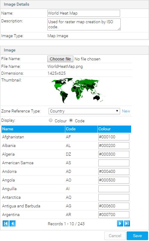
- To load a Raster Map Image, ensure that your image has unique colour for every region required.
- Ensure that you have reference code setup for your map data. E.g. For the example in Yellowfin you have a country reference code defined by ISO code. These ISO codes will be linked to each zone.
- Similar to loading an image click the add link, provide a name and select map type.
- You will now see a Map details section. For a basic Map you can leave the reference type as None.
- In the layer section you will have to load the actual image you want to use. Maps support multiple layers for the same map. For example you could have a layer for country or region which uses the same world outline.
- On the layer choose the name and description for the image layer that you are loading
- Browse and upload the map you want to load.
- Choose layer as the layer type.
- Choose the zone reference type. This is used to link the zones to specific reference code values.
- For each colour select the appropriate reference code value.
- Click Save to save your Raster map.
See Image Map Tutorial for more information.
| horizontalrule |
|---|
| Styleclass | ||
|---|---|---|
| ||